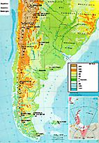
Argentine Republic
of the Military Geographical Institute
The maximun lenght between north and south is 3.694 Km. (2,295 miles) If we extend it to the South Pole, it reaches about 7,590 Km. (4,716 miles) A consequence of this is the wide variety of climates that the country offers, from tropical and subtropical warm climate in the norh, to polar cold in Antarctica.
The maximun lenght in regard to longitudes is 1.423 Km. (884 miles) It goes from the province of Misiones to the catamarqueña puna.
Apart from the american and antarctic portions, the Argentine Republic also has an oceanic portion, composed by some islands, the bottom of the ocean and the oceanic mass, as established by the Convention of the Sea in 1982 .